


Lake Cumberland Area Development District (West) PUMA, Kentucky
About
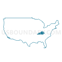
Outline
+PUMA%2c+Kentucky_A280.png)
Summary
| Unique Area Identifier | 192993 |
| Name | Lake Cumberland Area Development District (West) PUMA |
| State | Kentucky |
| Area (square miles) | 2,222.94 |
| Land Area (square miles) | 2,157.96 |
| Water Area (square miles) | 64.98 |
| % of Land Area | 97.08 |
| % of Water Area | 2.92 |
| Latitude of the Internal Point | 37.10724700 |
| Longtitude of the Internal Point | -85.21642880 |
Maps
+PUMA in Kentucky.png)
Graphs
Select a template below for downloading or customizing gragh for Lake Cumberland Area Development District (West) PUMA, Kentucky
+PUMA%2c+Kentucky_T0.png)
+PUMA%2c+Kentucky_T1.png)
+PUMA%2c+Kentucky_T2.png)
+PUMA%2c+Kentucky_T3.png)
+PUMA%2c+Kentucky_T4.png)
+PUMA%2c+Kentucky_T5.png)
+PUMA%2c+Kentucky_T6.png)
+PUMA%2c+Kentucky_T7.png)
+PUMA%2c+Kentucky.png)
Neighbors
Neighoring Public Use Microdata Area (by Name) Neighboring Public Use Microdata Area on the Map
- Barren River Area Development District (Outer) PUMA, KY
- Bluegrass Area Development District (South) PUMA, KY
- Lake Cumberland Area Development District (East) PUMA, KY
- Lincoln Trail Area Development District (East) PUMA, KY
- Putnam, Overton, Jackson, Clay & Pickett Counties PUMA, TN
Top 10 Neighboring County (by Population) Neighboring County on the Map
- Pulaski County, KY (63,063)
- Boyle County, KY (28,432)
- Lincoln County, KY (24,742)
- Taylor County, KY (24,512)
- Wayne County, KY (20,813)
- Marion County, KY (19,820)
- Adair County, KY (18,656)
- Hart County, KY (18,199)
- Russell County, KY (17,565)
- Casey County, KY (15,955)
Top 10 Neighboring County Subdivision (by Population) Neighboring County Subdivision on the Map
- Campbellsville CCD, Taylor County, KY (18,935)
- Lebanon CCD, Marion County, KY (10,231)
- Russell Springs CCD, Russell County, KY (8,788)
- Columbia CCD, Adair County, KY (8,331)
- Albany CCD, Clinton County, KY (7,345)
- Tompkinsville CCD, Monroe County, KY (6,917)
- Liberty CCD, Casey County, KY (6,491)
- Hustonville CCD, Lincoln County, KY (5,739)
- Science Hill CCD, Pulaski County, KY (5,534)
- Waynesburg CCD, Lincoln County, KY (5,456)
Top 10 Neighboring Place (by Population) Neighboring Place on the Map
- Campbellsville city, KY (9,108)
- Columbia city, KY (4,452)
- Russell Springs city, KY (2,441)
- Liberty city, KY (2,168)
- Greensburg city, KY (2,163)
- Albany city, KY (2,033)
- Jamestown city, KY (1,794)
- Burkesville city, KY (1,521)
- Summersville CDP, KY (568)
- Marrowbone CDP, KY (217)
Top 10 Neighboring Unified School District (by Population) Neighboring Unified School District on the Map
- Pulaski County School District, KY (51,811)
- Lincoln County School District, KY (24,742)
- Marion County School District, KY (19,820)
- Adair County School District, KY (18,656)
- Russell County School District, KY (17,565)
- Wayne County School District, KY (16,922)
- Casey County School District, KY (15,955)
- Taylor County School District, KY (15,911)
- Hart County School District, KY (15,438)
- Boyle County School District, KY (14,852)
Top 10 Neighboring State Legislative District Lower Chamber (by Population) Neighboring State Legislative District Lower Chamber on the Map
- State House District 38, TN (60,599)
- State House District 83, KY (46,457)
- State House District 52, KY (44,854)
- State House District 19, KY (44,553)
- State House District 80, KY (44,415)
- State House District 51, KY (43,168)
- State House District 24, KY (41,610)
- State House District 54, KY (40,149)
- State House District 53, KY (39,176)
Top 10 Neighboring State Legislative District Upper Chamber (by Population) Neighboring State Legislative District Upper Chamber on the Map
- State Senate District 17, TN (208,424)
- State Senate District 15, TN (193,013)
- State Senate District 22, KY (126,095)
- State Senate District 34, KY (124,714)
- State Senate District 14, KY (120,817)
- State Senate District 5, KY (115,364)
- State Senate District 15, KY (115,239)
- State Senate District 9, KY (112,974)
- State Senate District 16, KY (102,847)
Top 10 Neighboring 111th Congressional District (by Population) Neighboring 111th Congressional District on the Map
- Congressional District 6, TN (788,754)
- Congressional District 2, KY (760,032)
- Congressional District 6, KY (759,205)
- Congressional District 4, TN (688,008)
- Congressional District 1, KY (686,989)
- Congressional District 5, KY (670,051)
Top 10 Neighboring Census Tract (by Population) Neighboring Census Tract on the Map
- Census Tract 9204, Taylor County, KY (7,729)
- Census Tract 9205, Taylor County, KY (6,845)
- Census Tract 9503, Casey County, KY (6,491)
- Census Tract 9707, Marion County, KY (5,768)
- Census Tract 9202, Lincoln County, KY (5,739)
- Census Tract 9302, Pulaski County, KY (5,534)
- Census Tract 9203, Lincoln County, KY (5,456)
- Census Tract 9601.02, Russell County, KY (5,186)
- Census Tract 9303, Pulaski County, KY (5,085)
- Census Tract 9251, Pickett County, TN (5,077)
Top 10 Neighboring 5-Digit ZIP Code Tabulation Area (by Population) Neighboring 5-Digit ZIP Code Tabulation Area on the Map
- 42718, KY (24,312)
- 40422, KY (24,280)
- 42633, KY (20,065)
- 42728, KY (15,925)
- 42642, KY (12,573)
- 40033, KY (12,355)
- 40484, KY (11,612)
- 42602, KY (10,216)
- 42539, KY (10,026)
- 42743, KY (8,869)